These maps should help put the ancestral Bußdiecker family farm near Buer, Sehlingdorf and Melle, in the Osnabrück region, into perspective with the rest of the country.
Above is an overall map of Germany. Osnabrück is in the low-lying northwest corner of the country, near the Netherlands. Windmills, canals, and streams are among the tourist sights in that area. The region is quite flat, compared to the country a little farther south.
This one shows the area including Bremen, Hannover, and Osnabrück. It also encompasses the area around the city of Münster, about 30 kilometers to the southwest of Osnabrück.
My brother Dan spent some time in Münster as an exchange student in the early 1960’s. At the same time, I was stationed with the Army in Bad Kreuznach, just south of the Rhine river cities of Wiesbaden and Mainz.
Unfortunately, at that time we knew nothing about our origins in Germany. It would have been a wonderful opportunity to learn more about the family.
– Roy F. Busdiecker, Jr.
Osnabrück lies in the German Land (State) of Niedersachsen, or Lower Saxony. Hannover, some 120 kilometers or about 75 miles to the east, is the Hauptstadt (capital) of Niedersachsen. Before the modern political boundaries were established, Osnabrück was a province of Prussia. Until 1866, that area was part of the Kingdom of Hannover. This may be the reason that many family members were told that the family emigrated from Hannover.
This map shows Landkreis Osnabrück. The Landkreis Osnabrück is roughly equivalent to a county in the United States. Note how the Land (State) border dips to the south just east of Osnabrück. Although it is part of Niedersachsen (Lower Saxony), it seems to lie more in the area of Nordrhein–Westfalen (North Rhine – Westphalia). Buer, Melle and Sehlingdorf, all mentioned in the family history, lie in the southeast corner of the Landkreis Osnabrück.
The Landkreis is made up of subordinate Gemeinde (communities or municipalities). The above map shows Gemeinde Melle. Notice how the southern border has the same shape as the boundary pointed out on the larger-area map of Landkreis Osnabrück. The Gemeinde Melle is roughly 20 kilometers or about 12 miles across in both north-south and east-west directions. The Buer – Sehlingdorf – Auf dem Bußdieck area is to the upper right of Melle.
Auf dem Bußdieck, or, Am Bußdieck is shown in the map above. Following the road to end, we arrive at the Bußdiecker family farm.
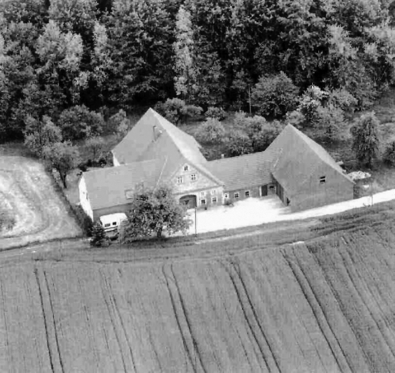
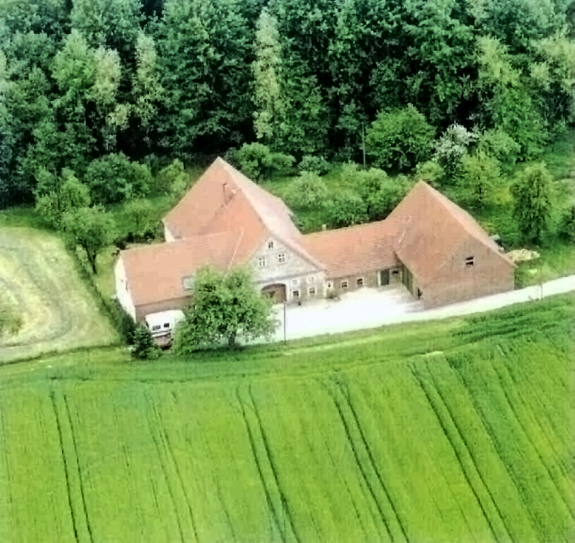
Above is a satellite image of the house overlooking the ancestral Bußdiecker family farm, a photo of which is shown below.
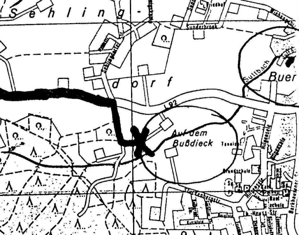
(“On the Bussdieck”)